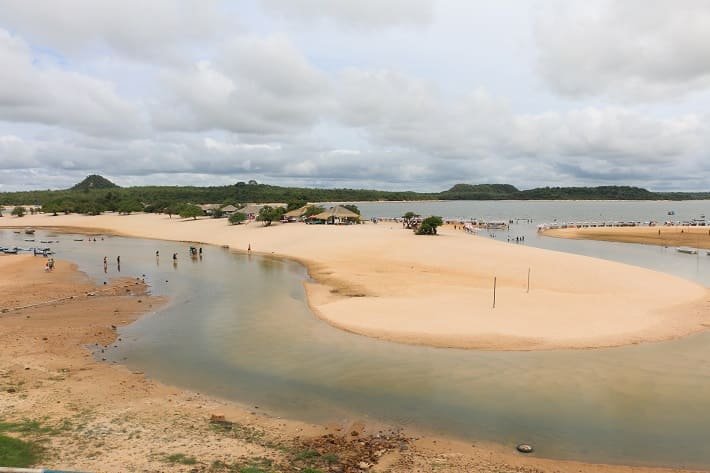
Exploring Cabo Frio in Brazil was a truly delightful surprise. While we were staying in Arraial do Cabo, we decided to take a day trip to the main city in the Lakes Region of Rio de Janeiro state, and it turned out to be an excellent decision.
Cabo Frio is a vibrant city with a population of 230,000 and boasts excellent infrastructure. The city is remarkably clean, pedestrian-friendly and features some of the most stunning beaches with crystal-clear waters, not to mention the beautiful Canal do Itajuru. It’s no wonder that it’s known as the “Little Princess of the Atlantic.”
Besides, the city has a rich history that dates back to before its founding in 1615, when Tupinambá tribes inhabited the region.
Cabo Frio (lit. ‘Cold Cape’) was named after a phenomenun that fascinated the old sailors: the local ocean currents had a substantially colder temperature than the normal temperatures of the Brazilian coast waters.
Cabo Frio is located about 160 km away from Santos Dumont Airport (SDU) in the city of Rio de Janeiro. It takes about three hours by car to get there from Rio de Janeiro city. Cabo Frio Airport (CFB), which is only 11 km away from the city center, is another way to reach the city. Azul Linhas Aéreas operate direct flights from Belo Horizonte (CNF) to Cabo Frio (CFB).
The Lakes Region in Rio de Janeiro state covers an area of 2,004.003 km² and consists of the municipalities surrounding the lagoons of Araruama, Saquarema, and Maricá. Cabo Frio, Arraial do Cabo, and Buzios are the Lakes Region’s main tourist spots.
In this article, we’ve presented a 1-day itinerary for Cabo Frio’s main attractions, but we highly recommend that you spend more time exploring this beautiful city. We covered the itinerary on foot, but there are other means of transportation available as well. Check it out!
Itinerary
1. Praia do Forte (beach)

Praia do Forte (Fort’s Beach) is Cabo Frio’s main beach, boasting white sand and crystal-clear waters. It’s named after the São Mateus Fort located nearby. It is a vast beach stretching over 7 km, with parts of it having calmer waters, and others featuring strong waves that attract surfers. On the beach, you can find several food and drink stalls.
During peak season, weekends, and holidays, some parts of the beach can get crowded (though not as much as the beaches in Arraial do Cabo). Nevertheless, due to Fort Beach’s large size, there’s always enough space for sunbathers.
If swimming isn’t your cup of tea, you can opt to take a leisurely walk along the delightful sidewalk that runs parallel to the beach.
For those seeking shade and fresh water, I suggest staying in one of the kiosks near São Mateus Fort, an area sheltered by plenty of trees. A sip of coconut water there is incredibly refreshing! The seawater in this area might be slightly darker, but the color contrast adds to the scenery’s charm.
2. Forte São Mateus (fort)
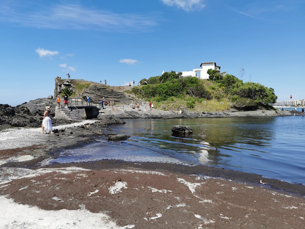
São Mateus Fort is a historical attraction that recounts Cabo Frio’s history. It was constructed between 1617 and 1620 on a rocky islet at the end of Praia do Forte. Its primary purpose was to safeguard the coastline against attacks from the French, Dutch, and English, who invaded the region during the seventeenth century due to the abundance of brazilwood. The fort replaced the old Fort Santo Inácio do Cabo Frio, which was situated on an islet in the Araruama Lagoon and was deemed excessively vulnerable to attacks.
The fort played a crucial role in consolidating Portuguese rule in the region and establishing the first settlement nuclei. Like all Portuguese fortresses, it was constructed using stone and lime masonry, in the shape of an irregular quadrangular polygon. It had seven cannons (some of which were removed) and five rooms, including the gunpowder house, the soldiers’ barracks, the commander’s room, the kitchen, and the prison.
Its location was strategic because it controlled maritime traffic and access to the Itajuru Canal, preventing “enemy” vessels from entering the interior. There were 88 lookout posts along the coast between Cabo Frio and Rio de Janeiro, which communicated via shots. The cannons of Fort São Mateus were not capable of shooting down enemy vessels, but they were useful in alerting troops of invasions.
In the nineteenth century, as several epidemics ravaged Cabo Frio, Fort São Mateus was transformed into a lazaretto, a place of isolation for patients with infectious and contagious diseases (1889 – 1920).

Like many Brazilian historical monuments, the fort underwent periods of neglect and restoration. It was designated as a Historical Heritage Site in 1956 and, more recently, came under the management of the City of Cabo Frio. Today, it is a cultural space and one of the most visited monuments in the city.
During our visit to Fort São Mateus in December 2021, we found a small room with some photographs and a poster telling the history of the Tamoios Confederation. Other rooms were under construction, indicating that the cultural space needs improvement. Nevertheless, the visit is worthwhile because the view from the fort is beautiful. Admission is free, and the attraction is open from 8 am to 6 pm.
3. Mirante do Forte (viewpoint)
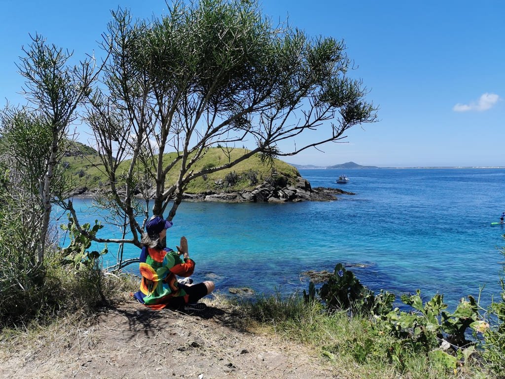
Next to the São Mateus Fort, a small beach with fishing boats is situated where seagulls can also be observed. On the left, a gentle climb takes you to the Mirante do Forte (viewpoint), which offers an incredible view of the Itajuru Canal, its blue waters, and the various boats that navigate through it.
- The Itajuru Canal, also known as the Canal of Araruama Lagoon, is a 6 km long canal that connects the Araruama Lagoon to the Atlantic Ocean.
In reality, at Mirante do Forte, there are several viewpoints that allow you to observe the whole region from different angles. Additionally, there is a staircase that leads you to the canal, which is used by some fishermen.
4. Bairro da Passagem (neighbourhood)

Imagine a charming, serene, well-preserved, and immaculate place. This is the Passagem neighborhood (Bairro da Passagem) of Cabo Frio, nestled on the banks of the Itajuru Canal. To reach it from Mirante do Forte, simply proceed down Almirante Barroso Avenue and make a right turn to access the waterfront.
Bairro da Passagem is the birthplace of Cabo Frio, where the first settlements in the city were established in the 17th century. By the way, it’s regarded as one of the oldest neighborhoods in Brazil.
- Bairro da Passagem (lit. Passage Neighbourhood) was named after being the point of the canal where the crossing was made during colonial times. There was a port on the shores of the Itajuru canal, which served as a point of embarkation and disembarkation of goods, including the traffic of slaves and Brazilwood, abundant in the native forests of the region.
As commerce migrated to the present-day city center, Bairro da Passagem was mainly inhabited by fishermen. However, many buildings in the colonial style, cobblestone streets, and a stunning waterfront have been preserved.
A stroll through the streets and a glimpse of the architecture are a “must-do” for visitors. Today, the neighborhood is home to numerous bars, restaurants, and inns.
Whenever I return to Cabo Frio, I want to stay there!

One of the area’s top attractions is the Chapel of São Benedito, built by slaves in the 18th century to honor their patron saint, Saint Benedict. After worship, the slaves congregated in the square outside the church to practice capoeira. It is worth noting that black people were not permitted to worship in the same churches as whites.
The Largo de São Benedito and its surroundings were designated for their architectural, historical, and cultural significance in 2002.
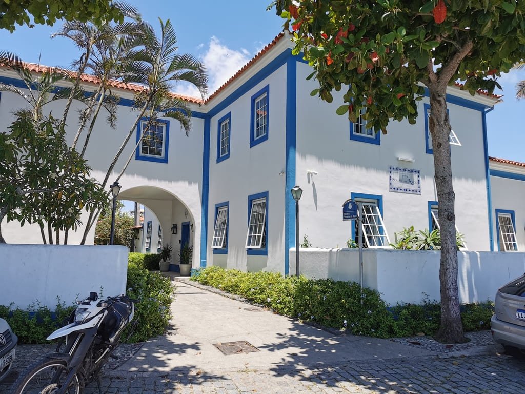
Another unmissable attraction is Beco do Príncipe, a mansion constructed by the Orleans and Bragança family (which used to be the Brazilian Royal Family when Brazil was a monarchy – XIX century) in 1958 in the Passagem neighborhood. Afterward, the family was informed that they could not construct the entire area of the land because a portion of it was a passage servitude utilized by local fishermen.
Consequently, part of the land was expropriated, and an archway was constructed, which became known as “Beco do Príncipe” (lit. Prince Alley).
5. Ilha do Japonês (island)
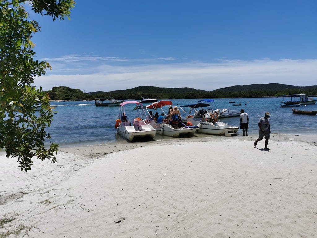
Ilha do Japonês (lit. Island of a Japanese guy) is located at the end of the Itajuru Canal. The island was named after a Japanese man called Itso Kawawa, who lived on the island.
Surrounded by beaches with crystal-clear blue waters, some consider the island to be the most beautiful place in Cabo Frio. Although there are no restaurants or other facilities for visitors on the island, you can easily find them on the mainland nearby.
To get to the island, you can take a “taxi boat” that departs from the Passagem neighborhood (landmark: Solar do Arco Hotel). The fare costs R$20 per person for a round trip. It’s important to arrange the return time with your boatman.
6. Walking to the City Center
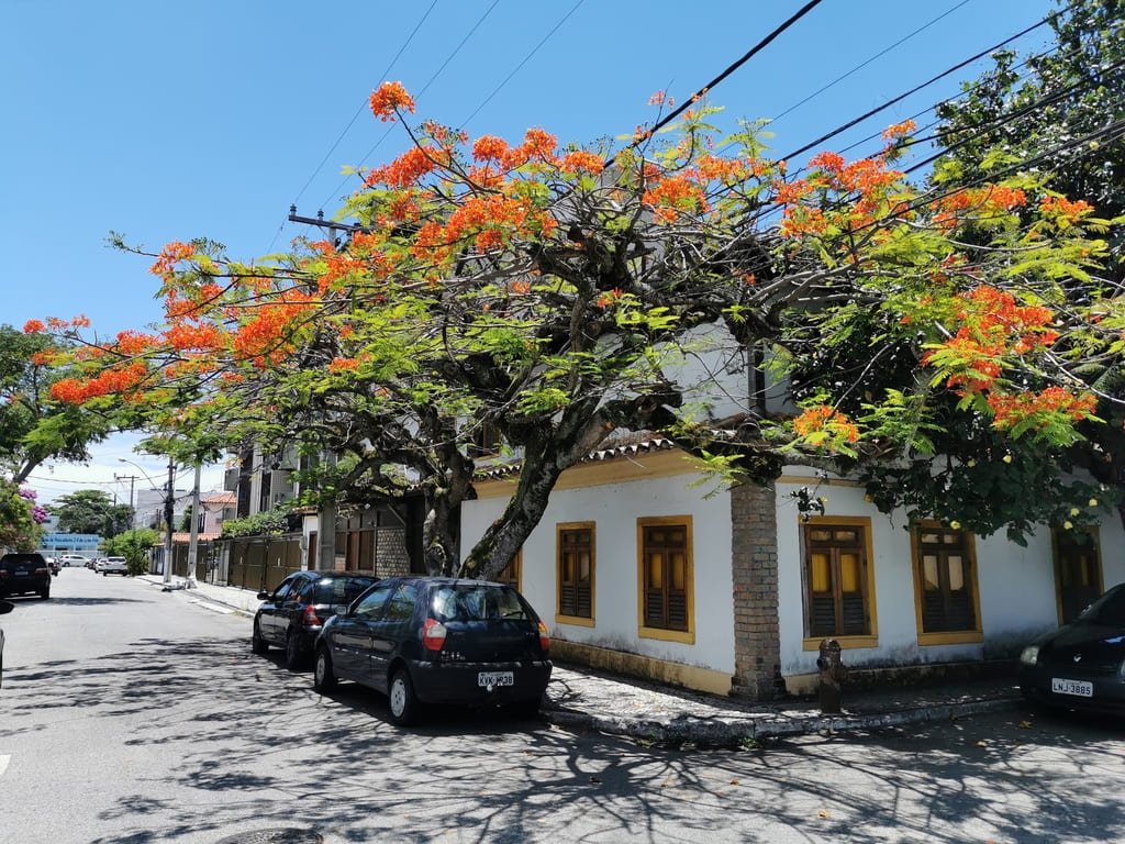
From the neighborhood of Passagem, we took Nossa Senhora da Assunção Avenue towards downtown Cabo Frio. Along this route, the buildings are more modern, but the neighborhood remains beautiful, clean, pleasant, and green.
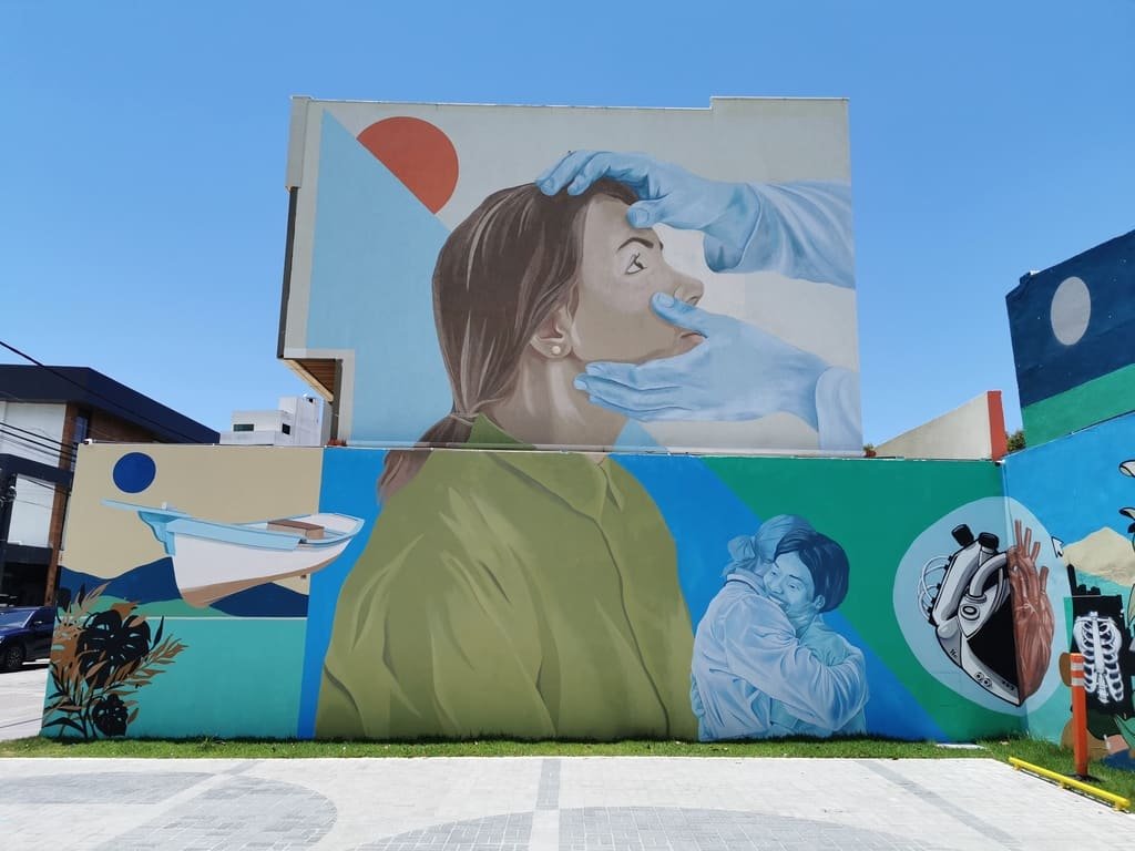
Turning right onto Hildebrando Assunção Street, we returned to the Cabo Frio Canal waterfront. On the way, the beautiful paintings on the walls of a building caught my attention.
7. Praia de São Bento (beach)
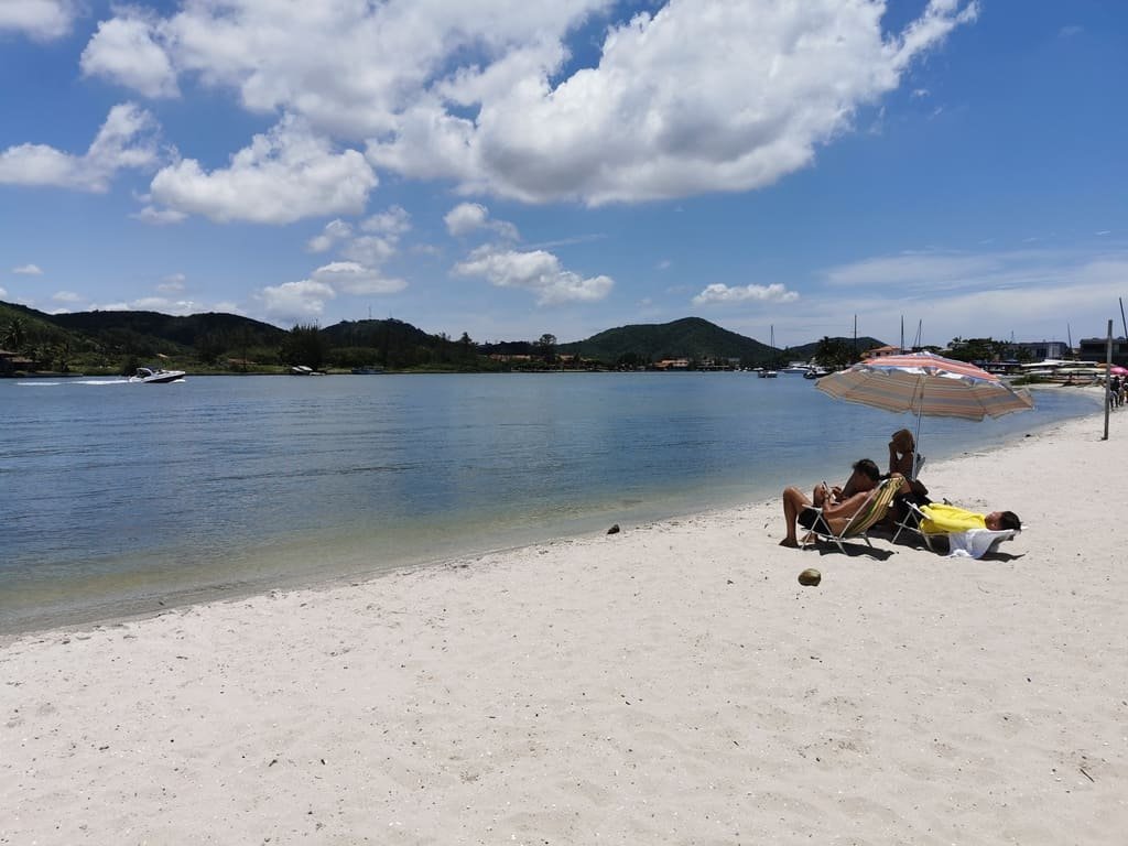
Next to a sidewalk made of Portuguese stones on Marechal Floriano Street, we find São Bento Beach (Praia São Bento). It is a freshwater beach with a small stretch of sand, but very pleasant and not very crowded. When we visited, only one family was enjoying that tranquility under their beach umbrella.
8. Lunch at Boulevard São Bento
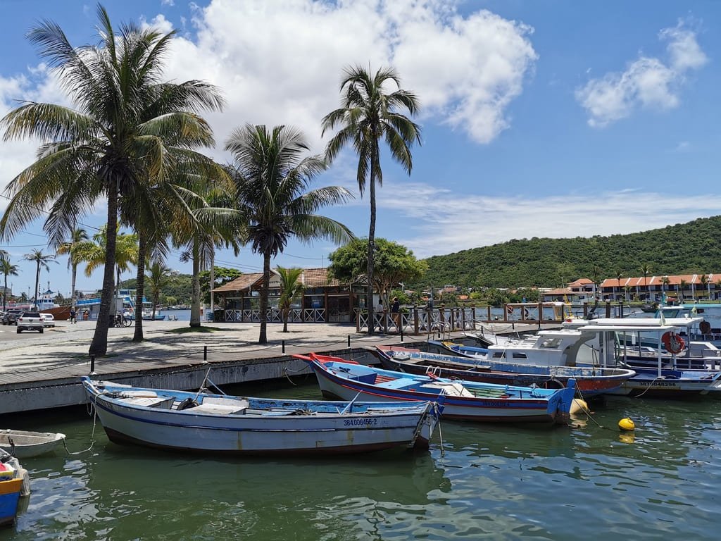
It’s lunchtime. Continuing along the banks of the canal, we found a boulevard with several options for restaurants, burger joints, snack bars, and ice cream parlors.
Several restaurants are well-rated on Tripadvisor, including:
- Tia Maluca (rating 4/5)
- Restaurante do Zé (rating 4/5)
- Brasileiríssimo (rating 5/5)
- Majará do Canal (rating 4/5)
- Galeto do Zé (rating 4/5)
- Picolino (rating 4.5/5).
We really enjoyed the Brasileiríssimo restaurant. It’s not an exceptional foodie experience, but the dishes are well-served and the food was good. The price was reasonable, and we were well-attended. The best of all is the view of the canal.
9. Porto Rocha Square

Porto Rocha Square (Praça Porto Rocha) is the central square of Cabo Frio. In the center of the square, there is a bandstand that has been revitalized by the City Hall. It is also where a Christmas tree is usually set up during the end-of-year celebrations.
In the surroundings, there are several commercial establishments such as pharmacies, supermarkets, banks, clothing stores, and so on.
10. Nossa Senhora da Assunção Church

What stands out the most in Porto Rocha Square is the Nossa Senhora da Assunção Mother Church (Igreja Matriz Nossa Senhora da Assunção), which began to be built in 1663 when the urban nucleus of Cabo Frio began to shift from the Passagem neighborhood to the current center (source: Wikipedia).
Built in the Baroque style, it is a small, simple but very beautiful church. Without a doubt, it is worth a visit!
11. Office Café Centro
After lunch, how about a cup of coffee? We quickly stopped at Office Café Centro, just a few meters from the church. The coffee shop is cozy and has good options for coffee, cakes, and sweets. The prices are reasonable. For example, an espresso cost R$ 5. Besides, there is nothing better than enjoying a little bit of air conditioning in that Cabo Frio heat.
Many people praise the vegan and low-carb options of this coffee shop. The service was excellent.
12. Morro da Guia (hill)

Morro da Guia is, literally and figuratively, the high point of our itinerary. Besides being one of Cabo Frio’s postcards, it is the perfect place to have a panoramic view of the city. A must-see! From there, you can’t see Cabo Frio’s beaches, but you can appreciate the city’s urban landscape and the beautiful scenery of the Itajuru Canal.
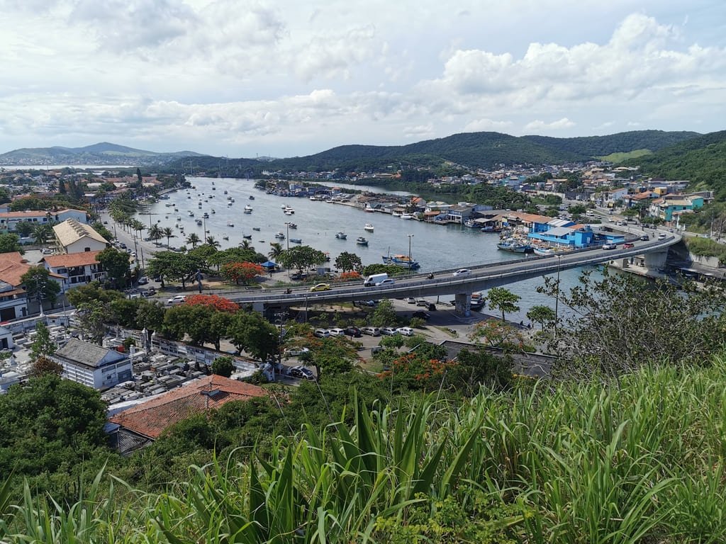
The entrance is located next to the MART – Museum of Traditional Religious Art (where the old convent used to operate), in the lower part, very close to the bridge over the Itajuru Canal.
The ascent of the hill is moderate. Go at your own pace! The walk takes 5 to 10 minutes. Access is via a stone street or a side staircase.
At the top, you will find the imposing Brazilian flag (12 square meters), a wooden deck, several viewpoints (with various angles of the city), a garden, and the Chapel of Our Lady of Guia.

The Chapel of Our Lady of Guia was built in 1740 in the baroque style by the Franciscan friars with the aim of having a place for prayer and contemplation of nature. The chosen location was excellent! In 1957, the chapel was declared a Historical Heritage Site.
Legend has it that the image of Our Lady of Guia had an altar dedicated to her in the convent of Our Lady of the Angels, in Largo Santo Antônio (a lower area nearby the hill). But whenever the image was placed there, it mysteriously appeared the next day on top of the hill behind the old convent. After several attempts, the “will” of the saint was made, and a chapel was erected on top of the hill, which in 1740 became known as Morro da Guia (Hill of the Guide) (source: cabofrio.rj.gov.br).
When we visited Morro da Guia, unfortunately, the chapel was not open, but we took the opportunity to rest a little at its entrance.
13. Rua dos Biquinis (Bikini St.)

Bikini Street (Rua dos Biquinis) is a covered boardwalk located in the Gamboa neighborhood, where several bikini shops are concentrated. I must confess that I don’t remember ever seeing another street with so many bikini shops. The prices are not cheap, but in one store or another, you can find some promotions. There are no men’s clothing stores. Anyway, I think it’s worth taking a stroll there, even if it’s just to take a walk and protect yourself from the sun.
To get to Bikini Street from Morro do Guia, just cross the bridge over the Itajuru Canal. It’s a 5-minute walk. The street is well signposted.
And our itinerary ends here, on Bikini Street, from where we took an Uber back to our hotel in Arraial do Cabo.
Bottom line
Cabo Frio is a city with excellent infrastructure, clean and very pleasant. Our itinerary allows you to explore the main attractions just by walking around the city (except for Ilha do Japonês).
The route took about 5 hours, already considering lunchtime. This is just an estimate, as each traveler has their own walking pace and may also spend more time at each point along the way.
Obviously, there are still other points in Cabo Frio worth visiting if you have more time, such as Praia das Conchas, Praia do Foguete, Praia das Dunas, and Ilha dos Papagaios.
Just don’t complain about the cold water (LoL)!

